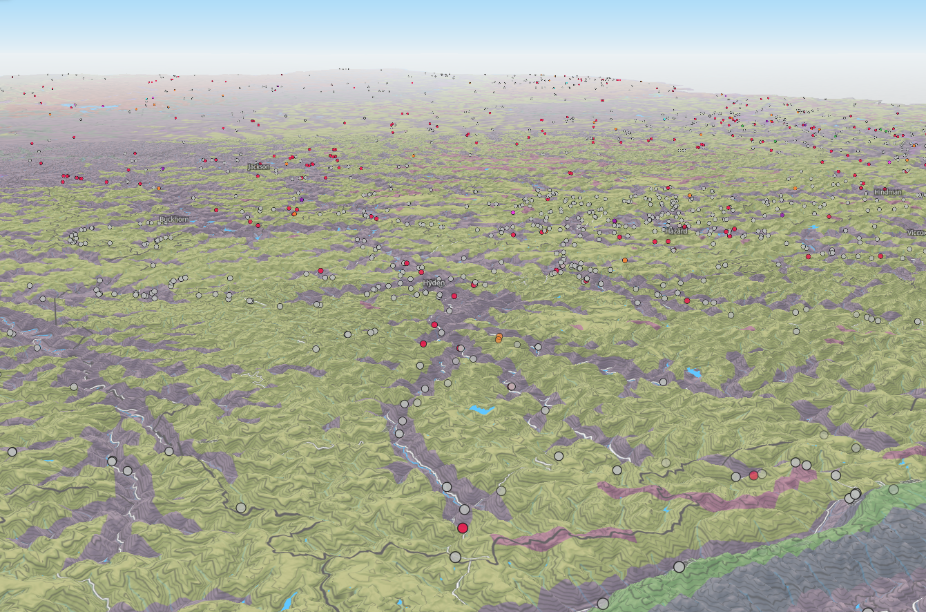
Appalachian Landslides
This web map explores appalachian landslides in Eastern Kentucky using MapLibre GL JS, PMTiles, Node.js, and more. Data was extracted from the Kentucky Geological Survey and prepped using QGIS 3.34.2 in NewMapsPlus MAP675 course.
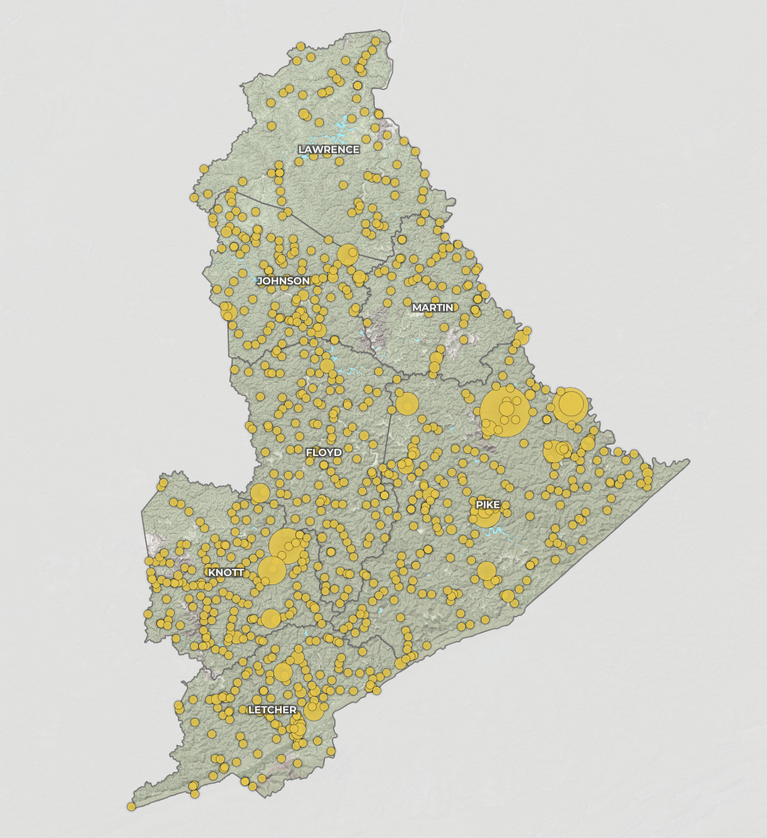
D12 Landslides / Rockfalls
Exploring techniques from NewMapsPlus MAP675, this web map shows landslides and rockfalls that occurred within KYTC Distrit 12 for KYTC Item No. 12-5020. Developed using Maplibre GL JS, PMTiles, and Node.js. Developed for Palmer Engineering in partnership with APSGEO.
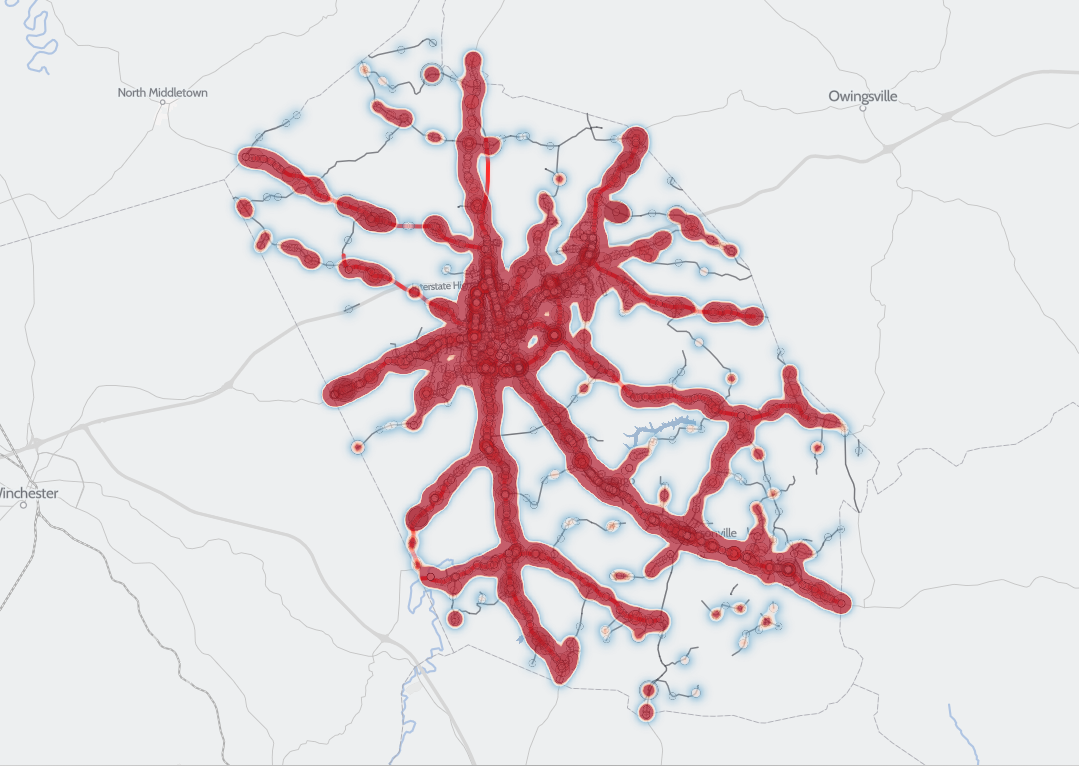
Montgomery Co. Safety Study
A digital map showing crashes in Montgomery County, KY from January 2015 to December 2024. Devleoped using Maplibre GL JS. Data prepared in QGIS 3.34.2 using SQL to identify high injury networks. Developed for NewMapsPlus MAP674
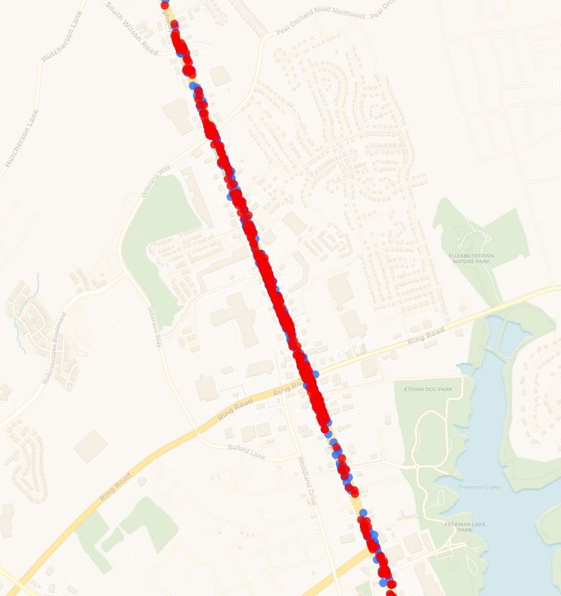
US-31W Improvements
An interactive web map using Leaflet.js and D3.js to show improvement in US-31W crashes after construction in Elizabethtown, KY. Map developed for KYTC District 4, courtesy of Palmer Engineering.
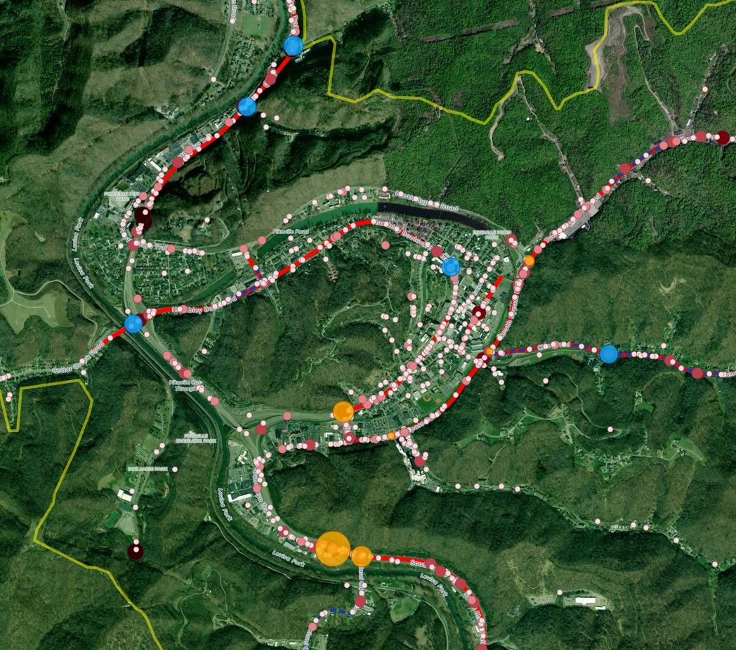
Pikeville Safety Action Plan
An interactive web map to showcase five-year crash data and safety initiatives for Pikeville's Safety Action Plan. Map developed using Leaflet.js and D3.js, courtesy of Palmer Engineering.
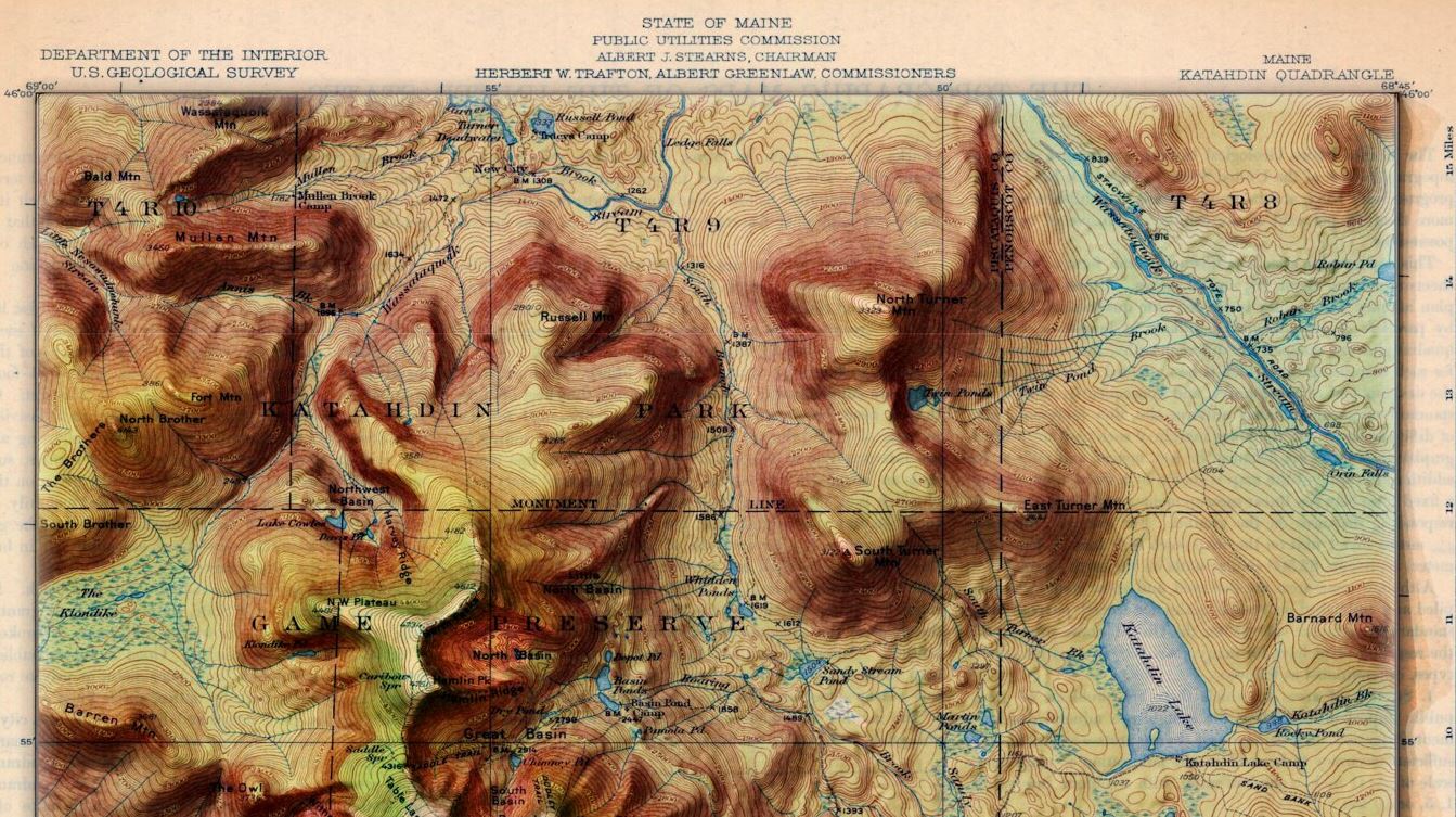
Modernized USGS Topographic Maps
USGS topographic maps are classy and beautiful. What if we added modern elevation data to them? This album answers that question. Developed using ArcGIS Pro.
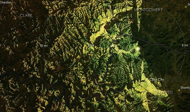
Illuminated Visibility Maps
Visibility maps for two of my favorite destinations inspired by John Nelson's online tutorials. Maps viewing Pilot Knob State Nature Sanctuary, KY and Mount San Jacinto State Park, CA. Developed using ArcGIS Pro.
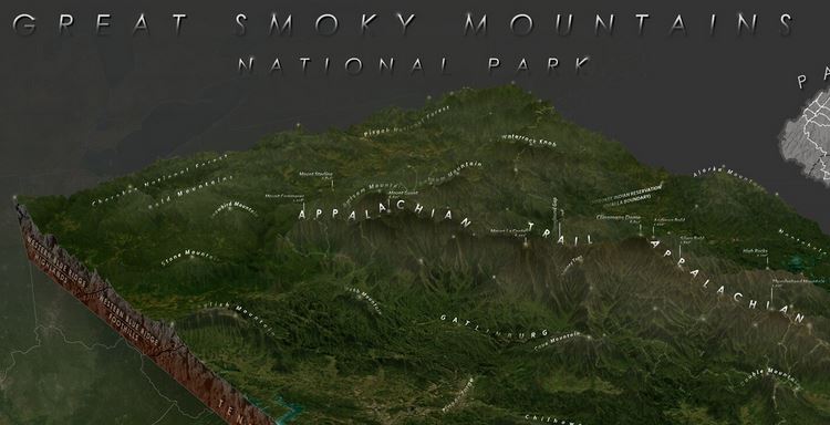
Smoky Mountains Nat'l Park - 3D
The Great Smoky Mountains are a wonder to behold. This static map explores the park as a 3-Dimensional "shoebox" cutout. Developed using ArcGIS Pro.
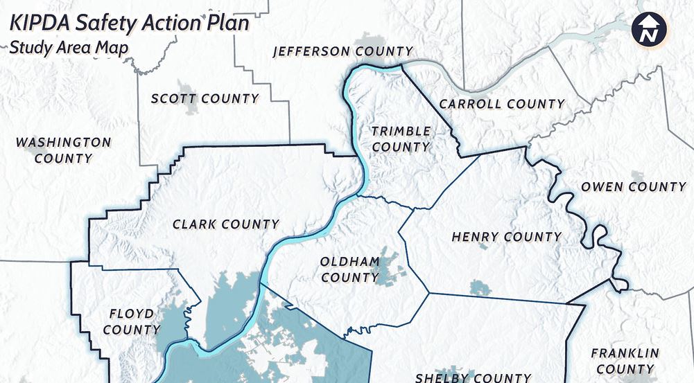
KIPDA SS4A Maps
A collection of static maps developed for Palmer Engineering in partnership with HDR Inc. for the KIPDA SS4A grant application. Maps developed using ArcGIS Pro and Python.